________________
374
THE INDIAN ANTIQUARY.
[DECEMBER, 1884.
157
8030
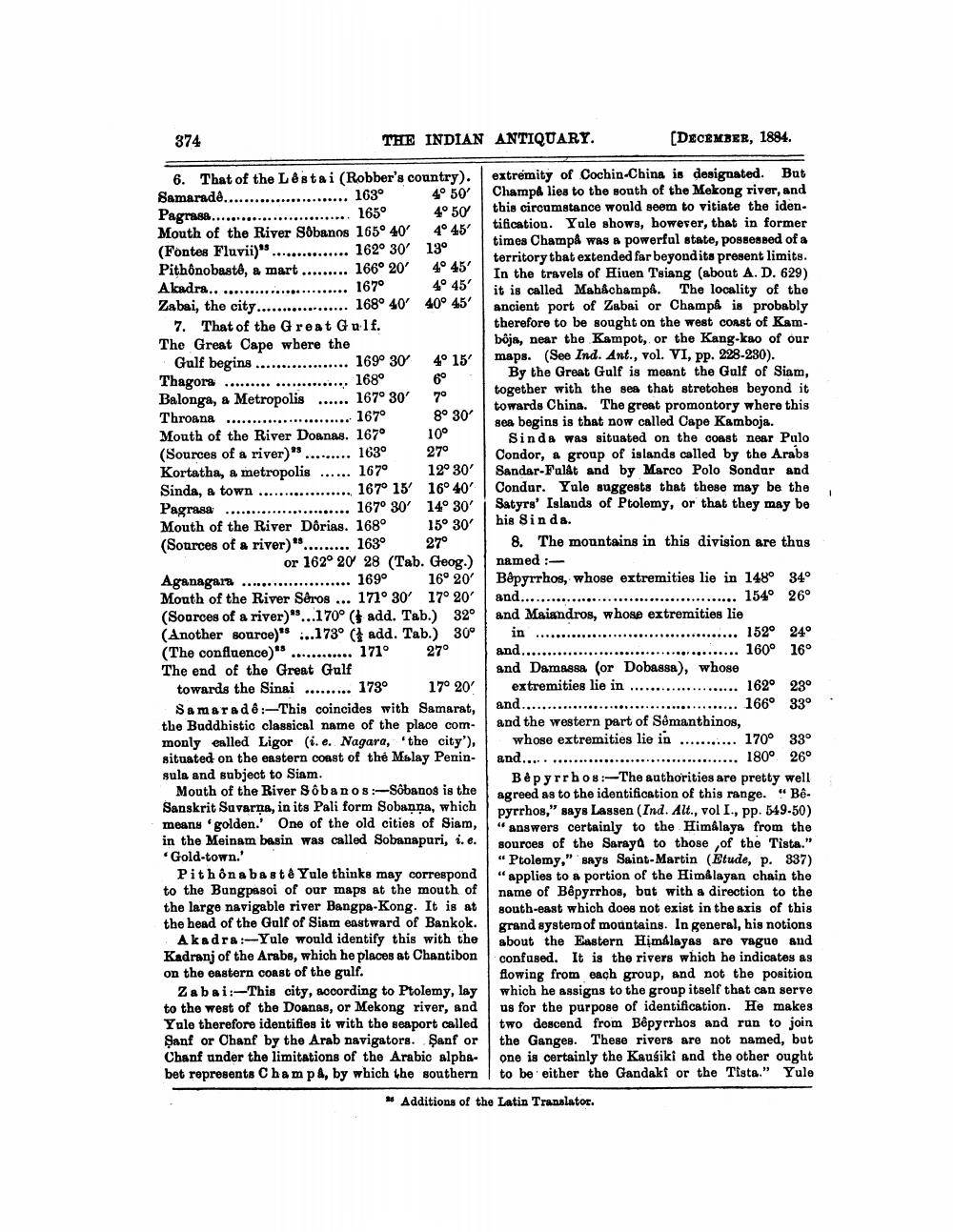
6. That of the Lêstai (Robber's country). Samarade........................ 163° 4° 50' Pagrase........................... 165° 4° 50 Mouth of the River Sobanos 165° 40' 4° 45' (Fontes Fluvii)" ............... 162° 30' 13° Pithônobastó, a mart ......... 166° 20' 4° 45' Akadra.......................... 167° 4° 45' Zabai, the city.................. 168° 40' 40° 45'
7. That of the Great Gulf. The Great Cape where the
Gulf begins .................. 1690 30 4° Thagora ....................... 168° Balonga, a Metropolis ...... 167° 30' 70 Throana ......................... 167o Mouth of the River Doanas. 167° 10° (Sources of a river)" .........
1630
27° Kortatha, a metropolis ...... 167° 12° 30' Sinda, a town .................. 167° 15 16° 40' Pagrasa .............. ..... 167° 30' 14° 30' Mouth of the River Dôrias. 168° 15° 30' (Sources of a river)"......... 163° 27°
or 162° 20 28 (Tab. Geog.) Aganagara ..................... 169° 16° 20' Mouth of the River Séros ... 171° 30' 17° 20' (Sources of a river)"...170° (add. Tab.) 32° (Another source)" ...173° ( add. Tab.) 30° (The confluence) ............ 171° 27° The end of the Great Gulf
towards the Sinai ......... 173° 17° 20' Samaradê:-This coincides with Samarat, the Buddhistic classical name of the place commonly called Ligor (i.e. Nagara, the city'), situated on the eastern coast of the Malay Peninsula and subject to Siam.
Mouth of the River Sôbanos:-Sõbanos is the Sanskrit Savarna, in its Pali form Sobanna, which means 'golden.' One of the old cities of Siam, in the Meinam basin was called Sobanapuri, i.e. Gold-town.'
Pithônabast & Yule thinks may correspond to the Bangpasoi of our maps at the mouth of the large navigable river Bangpa-Kong. It is at the head of the Gulf of Siam eastward of Bankok.
Akadra:-Yule would identify this with the Kadranj of the Arabs, which he places at Chantibon on the eastern coast of the gulf.
Zabai:-This city, according to Ptolemy, lay to the west of the Donnas, or Mekong river, and Yule therefore identifies it with the seaport called Şanf or Chanf by the Arab navigators. Şanf or Chanf under the limitations of the Arabic alphabet represents Champ 4, by which the southern
extremity of Cochin-China is designated. But Champa lies to the south of the Mekong river, and this circumstance would seem to vitiate the iden. tification. Yule shows, however, that in former times Champå was a powerful state, possessed of a territory that extended far beyond its present limits. In the travels of Hiuen Tsiang (about A. D. 629) it is called Mah&champå. The locality of the ancient port of Zabai or Champå is probably therefore to be sought on the west coast of Kambôja, near the Kampot, or the Kang-kao of our maps. (See Ind. Ant., vol. VI, pp. 228-230).
By the Great Gulf is meant the Gulf of Siam, together with the sea that stretches beyond it towards China. The great promontory where this sea begins is that now called Cape Kamboja.
Sinda was situated on the coast near Palo Condor, a group of islands called by the Arabs Sandar-Fuldt and by Marco Polo Sondur and Condur. Yule suggests that these may be the Satyrs' Islands of Ptolemy, or that they may be his Sinda.
8. The mountains in this division are thus named : Bêpyrrhos, whose extremities lie in 148° 34° and.......................................... 154° 26° and Maiandros, whose extremities lie
in ....................................... 152° 24° and.............
............. 160° 16° and Damassa (or Dobassa), whose
extremities lie in ..................... 162° 23° and.......................................... 166° 33° and the western part of Sémanthinos, whose extremities lie in ........... 170° 33°
................. 180° 26° Bêpyrrhos:--The authorities are pretty well agreed as to the identification of this range." Bê. pyrrhos," says Lassen (Ind. Alt., vol I., pp. 549-50) "answers certainly to the Himalaya from the sources of the Saraya to those of the Tista." "Ptolemy," says Saint-Martin (Etude, p. 337) "applies to a portion of the Himalayan chain the name of Bêpyrrhos, bat with a direction to the south-east which does not exist in the axis of this grand system of mountains. In general, his notions about the Eastern Himalayas are vague and confused. It is the rivers which he indicates as flowing from each group, and not the position which he assigns to the group itself that can serve us for the purpose of identification. He makes two descend from Bêpyrrbos and run to join the Ganges. These rivers are not named, but one is certainly the Kausiki and the other ought to be either the Gandaki or the Tista." Yule
and.......
* Additions of the Latin Translator.


