________________
Chapter 01
Introduction to Research
approaches show yield consistent when applied to the same reach or if incision profiles along nearby parallel reaches are compared. In the Sub-Himalaya, river incision is rapid, with values up to 10-15 mm/yr. It does not exceed a few millimeters per year in the Lesser Himalaya, and rises abruptly at the front of the high range to reach values of ~4-8 mm/yr within a 50-km-wide zone that coincides with the position of the highest Himalayan peaks, perhaps Mount Kailas and Mount Ashtapad. Sediment yield derived from the measurement of suspended load in Himalayan river/s suggests that fluvial incision drives hill-slope denudation of the landscape at the scale of the whole range. The observed pattern of erosion is found to closely mimic uplift as predicted taking into account erosion and slip along the flat-ramp-flat geometry of the Main Himalayan Thrust fault (cf. Figure 11). The morphology of the range reflects a dynamic equilibrium between presentday tectonics and surface processes. The sharp relief together with the high uplift rates in the Higher Himalaya reflects thrusting over the mid-crustal ramp rather than an isostatic response to re-incision of the Tibetan Plateau driven by late Cenozoic climate change, or late Miocene reactivation of the Main Central Thrust. Carretier et al., (2009) explored the extent to which it is possible to convert erosion rate data into uplift rate or erosion laws, using a landscape evolution model. Transient stages of topography and erosion rates of a block uplifting at a constant rate are investigated at different spatial scales, for a constant climate, and for various erosion laws and initial topographies. They identified three main model types for the evolution of the mountain-scale mean erosion rate. Observations of a mountain in the Gobi-Altay range in Mongolia support the exponentialtype model. This suggests that the erosion of this mountain is either detachment-limited or transport-limited with a significant transport threshold. This study shows that drainage growth could explain differences in erosion rate measurements on different spatial scales in a catchment.
What sets up the maximum elevation of a
topography?
Maximum Strength
Pricing Sich
Equilibrium between
driving and resisting forces described by Argand number
Transition
tie now
Jeshd
Gravitational forces Compressive forces
dad
este ne
fo.ch
CONTINENTAL THOSHORE
However, the height of the topography will also increase with the viscosity or the horizontal convergence.
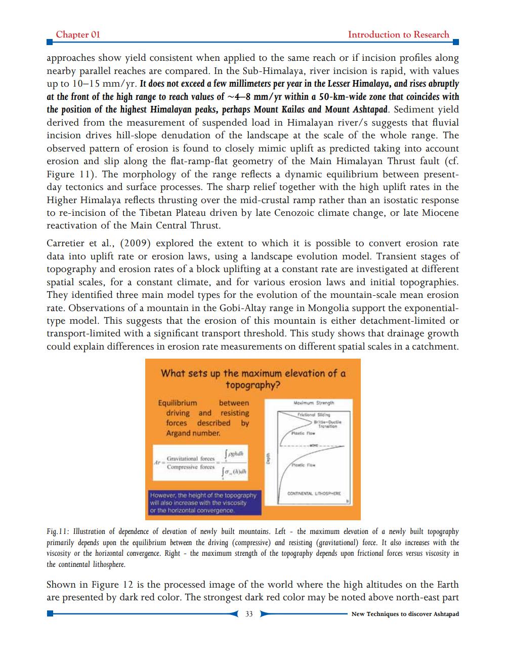
Fig.11: Illustration of dependence of elevation of newly built mountains. Left - the maximum elevation of a newly built topography primarily depends upon the equilibrium between the driving (compressive) and resisting (gravitational force. It also increases with the viscosity or the horizontal convergence. Right - the maximum strength of the topography depends upon frictional forces versus viscosity in the continental lithosphere.
Shown in Figure 12 is the processed image of the world where the high altitudes on the Earth are presented by dark red color. The strongest dark red color may be noted above north-east part
New Techniques to discover Ashtapad