________________
Chapter 05
Geological Studies
shaped the present day landscape that we see around Kailash and Nandi Mountain and are discussed below. Glacial Activity Masses of moving ice known as glaciers are one of the most effective sculptures (geomorphic agent) on the earth surface which have transformed the appearance of the higher Himalayan ranges. Moving masses of ice not only erode the valley bottom, but also effectively plucks the valley walls thus forming broad 'U' shaped valleys which are typical features of a glaciated terrain. Widespread occurrence of such valleys has been found in the Kailash region indicating that there was a time when glaciers were more extensive compared to present. Serlung Chu valley
Rakshas Tal
Serlung Gompa
S-I
Serlung Chu
S-II
S-M
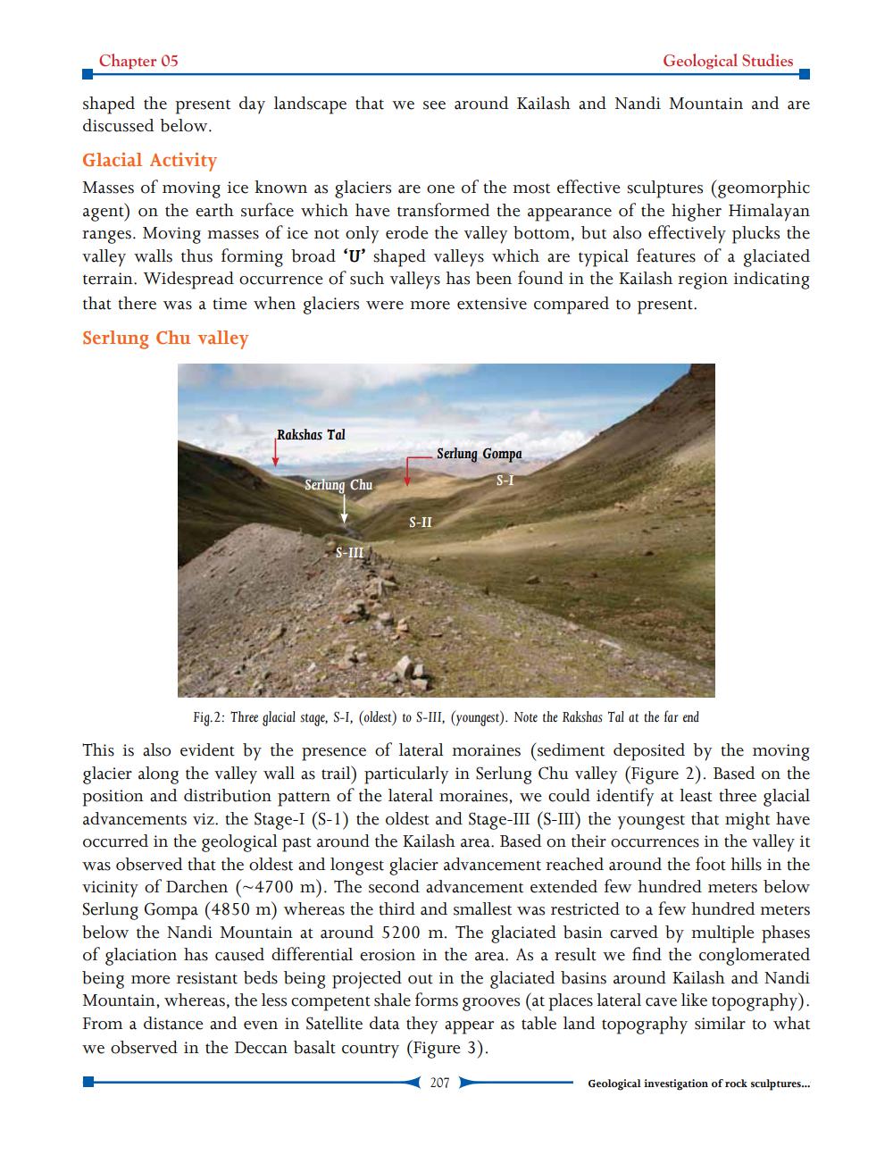
Fig.2: Three glacial stage, S-I, (oldest) to S-III, (youngest). Note the Rakshas Tal at the far end
This is also evident by the presence of lateral moraines (sediment deposited by the moving glacier along the valley wall as trail) particularly in Serlung Chu valley (Figure 2). Based on the position and distribution pattern of the lateral moraines, we could identify at least three glacial advancements viz. the Stage-I (S-1) the oldest and Stage III (S-III) the youngest that might have occurred in the geological past around the Kailash area. Based on their occurrences in the valley it was observed that the oldest and longest glacier advancement reached around the foot hills in the vicinity of Darchen (~4700 m). The second advancement extended few hundred meters below Serlung Gompa (4850 m) whereas the third and smallest was restricted to a few hundred meters below the Nandi Mountain at around 5200 m. The glaciated basin carved by multiple phases of glaciation has caused differential erosion in the area. As a result we find the conglomerated being more resistant beds being projected out in the glaciated basins around Kailash and Nandi Mountain, whereas, the less competent shale forms grooves (at places lateral cave like topography). From a distance and even in Satellite data they appear as table land topography similar to what we observed in the Deccan basalt country (Figure 3).
207
Geological investigation of rock sculptures...