________________
Chapter 05
Geological Studies
of conjugate sets trending nearly perpendicular to the orographic strike (EW) and have been recognized throughout the expanse of the Himalaya. The dominant trend is NNE - SSW (Fig. 4.13, p.51). The best example of strike-slip fault in the Himalayan heights is the Karakoram fault in North Ladakh.
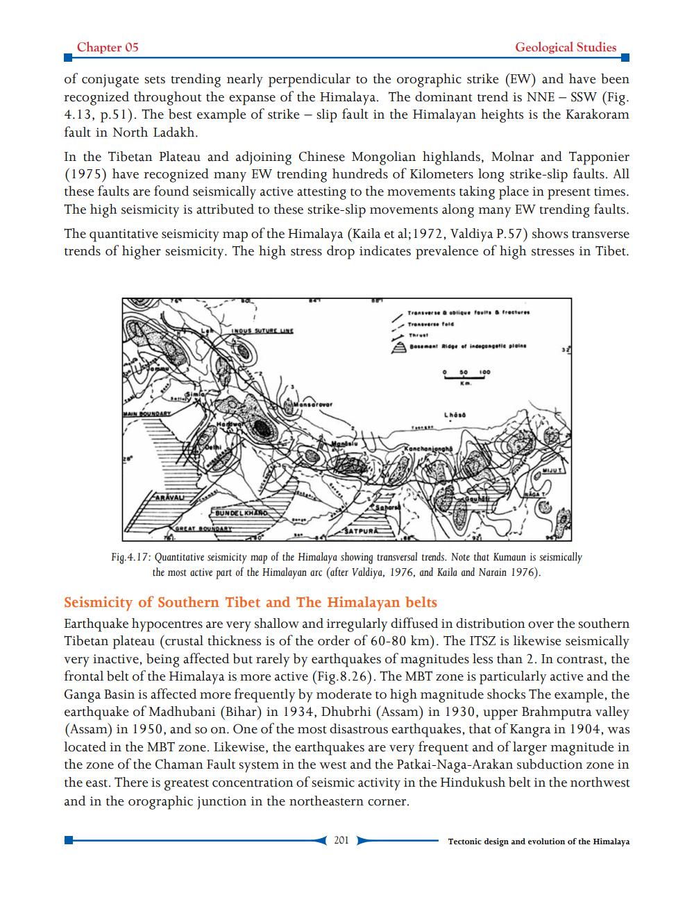
In the Tibetan Plateau and adjoining Chinese Mongolian highlands, Molnar and Tapponier (1975) have recognized many EW trending hundreds of Kilometers long strike-slip faults. All these faults are found seismically active attesting to the movements taking place in present times. The high seismicity is attributed to these strike-slip movements along many EW trending faults. The quantitative seismicity map of the Himalaya (Kaila et al; 1972, Valdiya P.57) shows transverse trends of higher seismicity. The high stress drop indicates prevalence of high stresses in Tibet.
MAIN BOUNDARY
FARAVAL
INOUS SUTURE LINE
Hardwar
BUNDELKHAND
GREAT BOUNDARY
Mandalu
Saharsa
SATPURA
Transverse & oblique faults & fractures Transverse fold
Thrust
Basement Ridge of incegangetic plains
201
Lhösö
Konchonjongha
100
AGA
MIJUT
Fig.4.17: Quantitative seismicity map of the Himalaya showing transversal trends. Note that Kumaun is seismically the most active part of the Himalayan arc (after Valdiya, 1976, and Kaila and Narain 1976).
Seismicity of Southern Tibet and The Himalayan belts
Earthquake hypocentres are very shallow and irregularly diffused in distribution over the southern. Tibetan plateau (crustal thickness is of the order of 60-80 km). The ITSZ is likewise seismically very inactive, being affected but rarely by earthquakes of magnitudes less than 2. In contrast, the frontal belt of the Himalaya is more active (Fig. 8.26). The MBT zone is particularly active and the Ganga Basin is affected more frequently by moderate to high magnitude shocks The example, the earthquake of Madhubani (Bihar) in 1934, Dhubrhi (Assam) in 1930, upper Brahmputra valley (Assam) in 1950, and so on. One of the most disastrous earthquakes, that of Kangra in 1904, was located in the MBT zone. Likewise, the earthquakes are very frequent and of larger magnitude in the zone of the Chaman Fault system in the west and the Patkai-Naga-Arakan subduction zone in the east. There is greatest concentration of seismic activity in the Hindukush belt in the northwest and in the orographic junction in the northeastern corner.
Tectonic design and evolution of the Himalaya