________________
Chapter 05
Geological Studies
Formation of Himalayas
Collision of Indian & Eurasian Plate
EURASIAN PLATE
Marine Sediments
Tethys
Asia
Sea
200 mya
India
Asia
INDIA Today
India
200 million years ago
To million years ago
LANKA
Marine Sediments
38 million years ago
Asia
Tethys
Eurasida
100 mya
India
Asia
India
44 million years ago
100 million years ago
INDIAN OCEAN
Himalaya Mountains
Asia
- 71 million
years ago
"INDLA"
Tibetan Plateau
Today
India
India
Today
- SRI LANKA
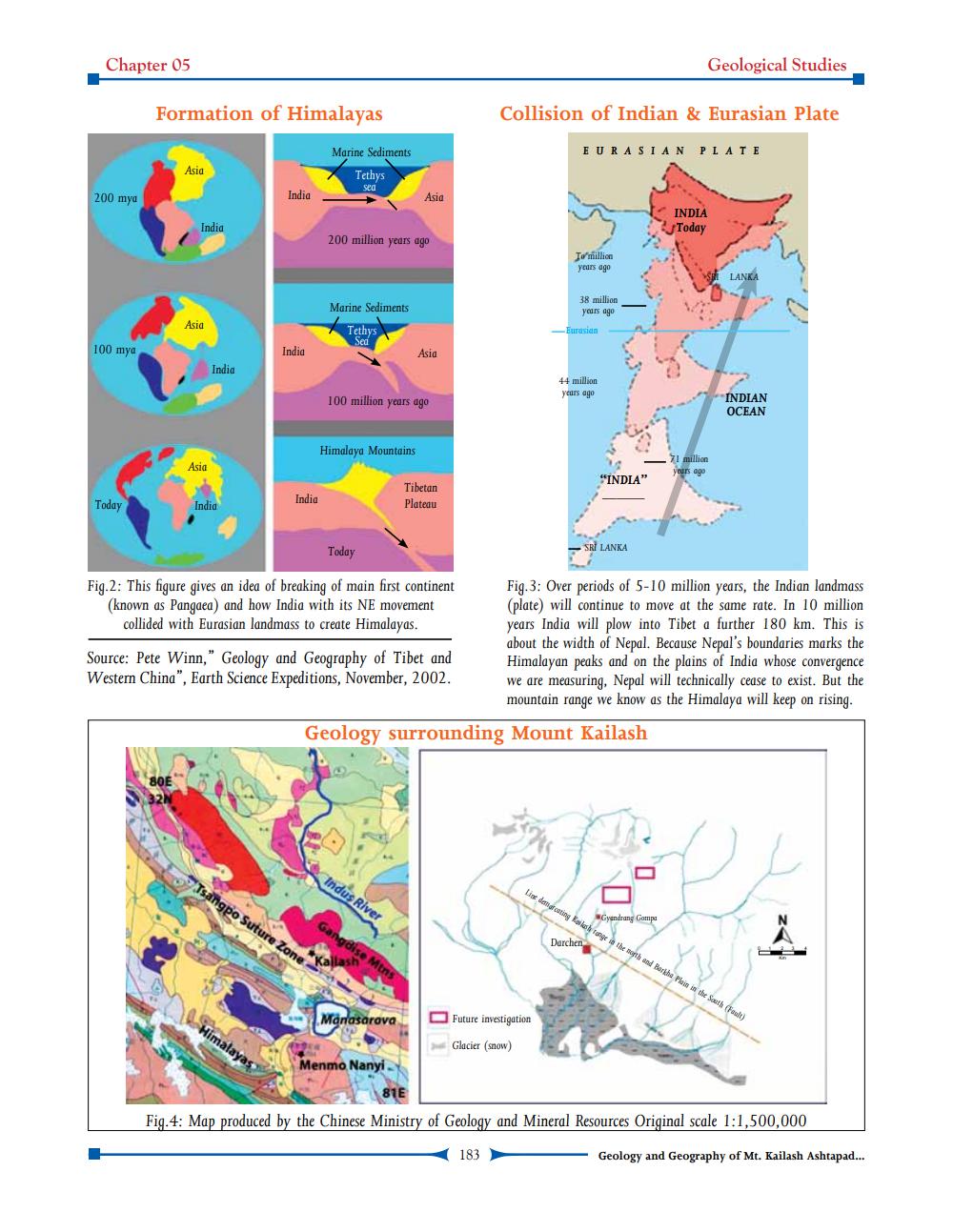
Fig.2: This figure gives an idea of breaking of main first continent (known as Pangaea) and how India with its NE movement
collided with Eurasian landmass to create Himalayas.
Fig.3: Over periods of 5-10 million years, the Indian landmass (plate) will continue to move at the same rate. In 10 million years India will plow into Tibet a further 180 km. This is about the width of Nepal. Because Nepal's boundaries marks the Himalayan peaks and on the plains of India whose convergence we are measuring, Nepal will technically cease to exist. But the mountain range we know as the Himalaya will keep on rising.
Source: Pete Winn," Geology and Geography of Tibet and Western China", Earth Science Expeditions, November, 2002.
Geology surrounding Mount Kailash
Indus River
Tsangpo Suture Zone
Lise demarcating only to get the month and Bertha Pleis in the South (Fault)
Gyandrang Gempa
Darchen
Manasarova
Future investigation
Glacier (snow)
Menmo Nanyi
Fig.4: Map produced by the Chinese Ministry of Geology and Mineral Resources Original scale 1:1,500,000
183
Geology and Geography of Mt. Kailash Ashtapad...